



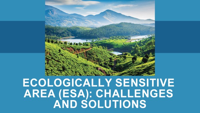
The Western Ghats are a mountain range extending for approximately 1,500 kilometres along the western coast of India, from the Tapti River in the north to Kanyakumari in the south, with an average elevation of more than 600 metres. Stretching across the six states of Gujarat, Maharashtra, Goa, Karnataka, Kerala, and Tamil Nadu, they constitute a unique natural landscape and an invaluable repository of biodiversity. Protecting the Western Ghats, which bring the monsoon rains that begin every year in the first week of June to these regions, is the responsibility of successive generations.
Environmental protection and human livelihood need not come into conflict. It is wrong to place farmers or ordinary people in the dock in the name of protecting the Western Ghats; equally wrong is to implement environmental protection measures by ignoring the legitimate concerns of farmers. The Government’s legislation should be guided by the UNESCO principle that human beings must remain at the centre of sustainable development while protecting the environment. However, attempting, through an ESA notification in the name of environmental protection, to convert lands containing residential areas, agricultural lands, and plantations into forest land, and to apply forest laws to revenue lands, including residential and agricultural areas, is entirely unscientific. Therefore, before the seventh draft ESA notification (Ecologically Sensitive Area) issued by the Union Ministry of Environment, Forest and Climate Change on 27 July 2026 is published as the final notification, comprehensive corrections, taking into account the realities of Kerala, are essential. In the new draft notification issued by the Union Ministry, an area of 56,825.7 square kilometres across six states has been proposed as ESA. Of this, 9,993.7 square kilometres covering 131 villages in twelve districts of Kerala have been included. The deadline for submitting comments and suggestions is 25 September 2026.
Incompleteness of Maps
One of the major problems concerning the ESA is that complete maps through which ordinary people can clearly understand the exact boundaries of the ESA are not available in the cadastral maps referred to in the draft notification. Moreover, since the cadastral maps have been unscientifically compiled at different scales, they are not adequate for geo-referencing and converting them into local records. Many of these maps have not been properly scaled to the required map scale of 1:4000. Therefore, it is impossible to determine and digitise the extent of the ESA from the cadastral maps. If the map is not readable and understandable to the people, the process of obtaining public opinion itself will remain incomplete.
Therefore, the Kerala Directorate of Environment and Climate Change and the Kerala State Biodiversity Board must immediately publish the following: the precise ESA boundary in each village; cadastral maps based on survey numbers/block numbers; the extent of forest land and protected land included in the ESA; and land-use maps clearly distinguishing plantation land, agricultural land, and residential areas. All these must be made immediately available to the public. At the same time, only the existing forest areas and protected areas, excluding residential areas, agricultural lands, and plantations, should be included in the ESA, and such maps should be urgently submitted to the Central Government. The final notification must clearly state that revenue villages in Kerala have not been included within the ESA limits of the areas so submitted.
Contradictions in the State Government’s ESA Reports
a) The Error in the Oommen
V. Oommen Committee Report
One of the most serious issues requiring examination in the history of ESA determination in Kerala is the finding that 9,107 square kilometres of land in 123 villages is forest land. Following the Kasturirangan Report, which was prepared without public participation, the then Oommen Chandy Government appointed a three-member expert committee headed by Oommen V. Oommen to conduct physical verification in order to address the concerns of the people. Based on the report prepared by the Oommen Committee, an area of 9,993.7 square kilometres in 123 villages of Kerala was proposed as ESA. The report indicates that 9,107 square kilometres of this was forest land and 886.7 square kilometres was non-forest land. The recommendation submitted by the State Government following the Committee’s report is the same recommendation that has been included in the previous six draft notifications as well as in the present seventh draft notification.
The 9,107 square kilometres of forest land recorded in the draft as ESA is, in reality, not the extent of forest area within the 123 villages; rather, according to the official records of the Forest Department at that time, it represents the total forest area of Kerala.
Therefore, the error in the said report of the Oommen V. Oommen Committee must be re-examined. Because of the ESA extent determined on the basis of this error, there remains a possibility that, through the final notification, lakhs of acres of agricultural land and residential areas inhabited by more than three million people may be converted into forest land. The authorities and officials must be prepared to rectify this error.
However, according to the records of the State Government concerning the number of villages, eight of the 123 villages have subsequently undergone administrative division. Therefore, the last two draft notifications show 131 villages, including the eight newly formed villages. It is understood that the maps of these new villages are not available on the website of the Kerala State Biodiversity Board, where the draft notification claims they are available.
b) The Village Should Not Be the Basic Unit of ESA
In Kerala’s distinctive geographical and social context, the most important correction required is to abandon the practice of declaring an entire village as an ESA. In the earlier proposals based on the Kasturirangan Report, the Oommen V. Oommen Committee itself pointed out that the approach of treating an entire village as ESA when a specified percentage of the village falls within the ESA boundary should be corrected. The same report states that in a densely populated state such as Kerala, where the availability of land per person is limited, a single village may contain forests, agricultural land, towns, hospitals, educational institutions, houses, plantations, commercial centres, and other establishments.
Therefore, a village is an administrative unit; it is not an ecological unit. Kerala has a history of even amending the law concerning the application of forest laws by excluding villages and limiting their application to wards. Moreover, the idea that the Western Ghats, spread across 546 panchayats, and the environment of Kerala, spread across nearly a thousand panchayats, can be protected by declaring all 131 villages as ESA under the present draft notification is nothing more than a pipe dream.
c) Residential Areas, Agricultural Lands and Plantations Must Be Excluded from the ESA
The Western Ghats region of Kerala is different from those in many other states. Here, human habitation, agriculture, and plantation cultivation have existed for centuries even on lands adjoining forest areas and possessing proper revenue records. Plantations of coffee, cardamom, pepper, rubber, tea, and other crops constitute the foundation of the local economy in many regions. The Oommen V. Oommen Committee Report has pointed out the need to clearly distinguish traditional plantations, agricultural land, residential areas, and natural areas.
d) Only Existing Forests and Protected Areas Should Be Clearly Included in the ESA
Protected areas such as national parks, wildlife sanctuaries, dams, and habitats of critically important wildlife species should be clearly included in the final ESA map. Therefore, a clear demarcation approach must be adopted whereby strong protection is provided to protected forest areas and areas of exceptional ecological importance, while the livelihood lands of ordinary farmers are not subjected to the same degree of restrictions.
e) Field Verification Must Be Conducted Again
Determining the ESA solely on the basis of satellite imagery increases the possibility of plantations appearing as forest land. Therefore, the final notification should be prepared by integrating satellite imagery, cadastral maps, field verification, and an opportunity for the people to examine the details. Greater credibility would be ensured if joint teams comprising representatives of the Revenue, Forest, and Agriculture Departments and the Gram Sabha conducted field verification in each ESA village. The recommendation of Gadgil was that the final decision should be taken by taking the Gram Sabhas into confidence.
Public Opinion Must Be Obtained by Making Accurate Records Available to the People
When public opinion is sought on including an area within the ESA, the precise map of the area, survey and location records, land-use pattern, and criteria for environmental protection must be made available to the people. The mere statement that a village is an ESA is incomplete and dangerous. What is the relevance of entering in the title deeds of land that the property falls within the ESA? A farmer must be able to ascertain whether his or her land is included in the ESA. If it is included, genuine public participation requires that the people be able to know why it was included and what criteria were applied. Based on the maps and proposals received by the panchayats concerning the proposed area, the respective panchayats had identified errors, conducted field surveys, and submitted corrections to the concerned departments. However, no further action was taken on these corrections, nor were the maps modified. The residential areas for which corrections had been made were not excluded. Moreover, it appears that eight villages that were not within the ESA limits have now been included in the Ecologically Sensitive Area. Under the seventh draft notification, the final notification may be issued at any time after 25 September.
Problems That May Be Faced by People if the ESA Final Notification Covers Revenue Villages, Residential Areas and Agricultural Lands
If the ESA boundary is incorrectly determined, the restrictions that may arise in future concerning land use and development activities, as well as uncertainties regarding permissions, are very serious.
1. Confusion Regarding Whether One’s Own Land Falls Within the ESA
If an entire revenue village is recorded as an ESA, the actual status of each survey number within that village will not be clear. A landowner may not even be able to find an answer to the basic question, “Does my land fall within the ESA?” without an accurate map.
2. Uncertainty Concerning Agricultural Lands and Plantations
If plantations of rubber, cardamom, coffee, tea, pepper, and other crops, as well as traditional agricultural lands, are included within the ESA, future land-use decisions may be subject to additional restrictions or permission procedures. This may create uncertainty, particularly regarding the use, development, transfer, and investment in farmers’ land.
3. Problems Concerning Houses and Construction
In areas where ESA restrictions apply, certain construction and development activities may be subject to specific restrictions and permission requirements. Therefore, even in an area that is currently a normal residential locality, future construction of a new house, expansion of an existing house, establishment of institutions, hospitals, schools, small commercial establishments, roads, or public works projects may require additional procedures for obtaining permissions.
4. Uncertainty Regarding the Economic Value of Land
Entering in the title deeds that a particular property falls within the ESA may create uncertainty concerning the sale and purchase of land, bank loans, investments, and other matters. In particular, if there is a dispute over whether a particular survey number is included in the ESA, prospective purchasers and financial institutions may exercise greater caution regarding the future use of the land.
5. Roads and Infrastructure
In ESA areas, environmental restrictions will become more relevant to infrastructure development such as roads, bridges, drinking-water projects, electricity, public institutions, and other basic facilities.If the ESA boundary is not accurately determined, even projects undertaken in the public interest may face unnecessary administrative obstacles.
6. Small-Scale and Micro Enterprises
Once an area is included within the ESA, restrictions may also affect existing and future small-scale and micro enterprises, and disputes may arise concerning development activities.
7. Problems Concerning the Land Rights of the Next Generation
There may be uncertainty regarding the extent to which land being cultivated today can be used by the next generation for constructing a house, expanding agriculture, starting a small enterprise, or for other lawful purposes. Therefore, the ESA issue is not merely a problem concerning today’s farmer; it is also an issue concerning the land-use rights of the next generation.
As part of the ESA declaration, a rights-based economic benefit, namely a “conservation incentive and compensation mechanism,” should be provided to local residents for the development restrictions and loss of opportunities they undertake in the interests of environmental protection. Such benefits should be made available to those who may have to forgo their livelihoods, way of life, and development activities for the protection of the Western Ghats. Unless such a mechanism is implemented, as is done in other countries, this will become a major form of exploitation. There can be no doubt that it would amount to a blatant violation of the fundamental rights guaranteed to citizens by the Constitution.
Although the protection of the environment and the Western Ghats is the responsibility of all the people living in nearly a thousand panchayats and more than 1,600 villages in Kerala, imposing the entire responsibility unilaterally upon more than three million poor people living in 131 villages and making them scapegoats, while allowing activities that harm the environment to continue at will in the interests of certain vested groups, will place the State in danger. The ESA declaration could make such a situation possible.
The objective of the ESA is to protect the Western Ghats, not to place the lives of the people of Kerala in uncertainty. No ESA without accurate data; no final notification without accurate maps.
Matters Requiring Urgent Attention
Let us now consider the remedies or responsibilities that need to be undertaken at various levels regarding the ESA issue.
Even though this is the seventh ESA draft notification of the Union Ministry of Environment, Forest and Climate Change, the Government is failing to address the concerns of the people.
The reason is that the draft notification has published maps, including maps with geo-coordinates, for the proposals of all the other states except Kerala. However, Kerala’s map or proposal is not included. Why is it not included? The Union Ministry of Environment, Forest and Climate Change has stated that Kerala has not yet submitted a proposal, but that Kerala’s ESA has been calculated at 9,993.7 square kilometers through physical verification, and that the cadastral map (the map containing survey numbers) has been published on the website of the Kerala State Biodiversity Board. The Ministry has directed the people to examine the map and, if they have any objections, submit them within 60 days of the publication of the notification, that is, by 25 September, either to the email address of the Ministry of Environment, Forest and Climate Change or by post. However, the map available on the website of the State Biodiversity Board is not accessible in a manner sufficient for ordinary people to submit their objections. Therefore, there remains a concern that the State Government has misled the Union Ministry of Environment, Forest and Climate Change as well as the people of Kerala in this regard. The draft notification states that objections are to be submitted after examining the map on the website of the Biodiversity Board. Such objections alone would have legal validity.
The Kerala Government and the Kerala State Biodiversity Board Must Take the Following Urgent Measures Before the Central Government Finalises the New Draft Notification:
One: Immediately rectify the discrepancy and error in the figure of 9,107 square kilometers of forest land in the 123/131 villages and submit a new report to the Centre. (The confusion appearing in the various reports submitted by Kerala must be resolved immediately: the 2014 proposal of 123 villages/9,993.7 sq. km.; the 2015 proposal of 119/9,993.7; the 2018 proposal of 92/8,656.46; the subsequent district-level verification proposal of 98/8,711.89; the 2024 proposal of 98/8,590.69; and the 2026 proposal of 131/9,993.70. The differences among these proposals must be resolved and an accurate map and report submitted.)
Two: Precisely determine the boundaries and prepare maps by completely excluding residential areas, agricultural lands, and traditional plantations from the ESA. Publish, as soon as possible, the corrected and criteria-based map on the website of the Biodiversity Board.
Three: Abandon the practice of treating the village as the basic unit of the ESA.
Four: Include only forest areas, protected areas, and areas having World Heritage status within the ESA.
Five: Make ESA maps available to the public in a form that enables ordinary people to examine them and submit objections, if any. The Gadgil and Kasturirangan Reports attach great importance to the Gram Sabhas. The sentiments and concerns of the people should be expressed through resolutions adopted by the Gram Sabhas and forwarded by the respective Panchayat governing bodies as official resolutions.
Six: Publish on the website the Oommen V. Oommen Committee Report, all ESA proposals submitted by the State Government, the letters sent to the Centre, and the details of the field verifications.
Seven: Establish help centres in every district where members of the public can examine the maps and submit complaints. Convene meetings of the affected panchayats and organise adalats to resolve the problems of the people.
Eight: Publish a simple ESA explanatory document in Malayalam.
Nine: After ensuring that the people are fully informed and convinced of the proposal, submit to and obtain approval from the Central Government for a zero-error proposal that completely excludes residential areas and agricultural lands, together with KML-format maps in which the geo-coordinates are clearly recorded. The final notification should be issued only after all complaints received have been examined.
The Western Ghats must be protected not by driving people out, but by standing together with the people. The seventh draft notification published at present is not a final decision. The Central Government itself has invited comments and suggestions. Therefore, this should be regarded as a crucial opportunity for Kerala to point out the errors and demand scientific corrections.
Dr. Chacko Kaalamprambil
